 Admiring the view from the Wrekin
 Looking back over the last few months I've set a new record for broken resolutions. In that I actually managed to break the one resolution I made myself before the New Year even started.
Not having the necessary skills to use crampons and ice-axes, or perhaps the finances to invest in acquiring them, I generally hibernate over winter and hit the hills in Spring. Fine, except that for the fact I have a weakness in the patellar tendon of my left knee. What this means is, until I regain my hill-fitness, I'm generally dependent on pain-killers and walking poles to get me down the first few descents. So at the end of last November, after one of my best and most challenging walking seasons, I vowed to continue walking through the winter wherever possible. While religiously maintaining the exercise regime that addresses the weakness in my knee.
So my grand total of seriously challenging walks to date since then? Two! Number of trips to the Gym? Far too few. In fact I only really kicked off 2015's walking season with a long overdue trip to the Wrekin last weekend. I've lost count of the number of times I've driven past it on the way home from Snowdonia. Its tree covered slopes standing in splendid isolation on the West Midlands Plain, the inselberg of the Midlands. Made a mental note to visit it one day, then completely forgot about it.
Even on a foggy Sunday morning in February the car park was heaving, showing now popular this hill is with the locals. There was even an entire family walking up it in onesies when I arrived and it didn't look like a charity challenge either. Perhaps that's just the way folk from Telford do things? But even in the most popular of places it's possible to find some peace and relative solitude. Not to mention fifty shades of mud at this time of year.
Its outlier the Ercall (pronounced Arkle), owned by the Shropshire Wildlife Trust is home to long abandoned quarries. Today they're better know for the Ercall unconformity. A collision of sedimentary and volcanic rock. It's now an SSSI, a paradise for naturalists, and often over-looked by visitors to the Wrekin.
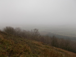
The Wrekin itself is a hill of two-halves. The north and south side being owned by two different estates with distinct land management styles. The popular route up the northern side is a wide, compacted, zigzag of a path that leads you easily to the summit. Skirting around the base of the hill will take you up the steeper, tree clad, southern slope and along the full extent of the Wrekin's ridge to the summit. On a clear day you can see over 80 square miles of countryside laid out before you. On other days a toposcope shows you what you could have seen.
The walk also gave me the opportunity to muse over a few short-story ideas. Given how universally foul the weather forecast is for my favourite walking grounds this weekend (snow, gales, rain, hill fog, etc.) I might just stop in and write one. Then again...
Not having the necessary skills to use crampons and ice-axes, or perhaps the finances to invest in acquiring them, I generally hibernate over winter and hit the hills in Spring. Fine, except that for the fact I have a weakness in the patellar tendon of my left knee. What this means is, until I regain my hill-fitness, I'm generally dependent on pain-killers and walking poles to get me down the first few descents. So at the end of last November, after one of my best and most challenging walking seasons, I vowed to continue walking through the winter wherever possible. While religiously maintaining the exercise regime that addresses the weakness in my knee.
So my grand total of seriously challenging walks to date since then? Two! Number of trips to the Gym? Far too few. In fact I only really kicked off 2015's walking season with a long overdue trip to the Wrekin last weekend. I've lost count of the number of times I've driven past it on the way home from Snowdonia. Its tree covered slopes standing in splendid isolation on the West Midlands Plain, the inselberg of the Midlands. Made a mental note to visit it one day, then completely forgot about it.
Even on a foggy Sunday morning in February the car park was heaving, showing now popular this hill is with the locals. There was even an entire family walking up it in onesies when I arrived and it didn't look like a charity challenge either. Perhaps that's just the way folk from Telford do things? But even in the most popular of places it's possible to find some peace and relative solitude. Not to mention fifty shades of mud at this time of year.
Its outlier the Ercall (pronounced Arkle), owned by the Shropshire Wildlife Trust is home to long abandoned quarries. Today they're better know for the Ercall unconformity. A collision of sedimentary and volcanic rock. It's now an SSSI, a paradise for naturalists, and often over-looked by visitors to the Wrekin.
The Wrekin itself is a hill of two-halves. The north and south side being owned by two different estates with distinct land management styles. The popular route up the northern side is a wide, compacted, zigzag of a path that leads you easily to the summit. Skirting around the base of the hill will take you up the steeper, tree clad, southern slope and along the full extent of the Wrekin's ridge to the summit. On a clear day you can see over 80 square miles of countryside laid out before you. On other days a toposcope shows you what you could have seen.
The walk also gave me the opportunity to muse over a few short-story ideas. Given how universally foul the weather forecast is for my favourite walking grounds this weekend (snow, gales, rain, hill fog, etc.) I might just stop in and write one. Then again...
 RSS Feed
